ORCA Warns About Potential Of Serious Flooding In Kawarthas

Otonabee Region Conservation Authority has issued a Flood Warning Update for all watercourses and waterbodies within the Otonabee Region watershed.

Current watershed conditions, combined with the latest weather forecast, suggest that water levels on the Kawartha Lakes (Buckhorn, Chemong, Pigeon, Lower Buckhorn, Lovesick, Stony, Clear and Katchewanooka Lakes) could experience unprecedented heights in the coming days. Therefore, residents on these lakes are advised to prepare now by taking appropriate steps to protect themselves, their family members, their pets and their personal property.

In particular, the following known historical flood-vulnerable areas are advised to take heed of this flood warning (note that this is not an exhaustive list)...

In addition, the Otonabee Conservation advises that the Otonabee River may also experience unprecedented water levels/flows as a result of current watershed conditions, combined with the updated weather forecast.

Therefore, residents located in historically flood-prone areas are hereby advised to take appropriate steps to protect themselves, their family members, their pets and their personal property ahead of the rising waters. In particular, the following known flood-vulnerable areas are advised to take heed of this flood warning: Cambelltown; Rosa Landing Road; Bensfort Bridge area; Jones Road; Deyell Road; Seven Oaks Drive; Wallace Point area; Cedar Bank Road; Green Acres Road; and, Willow Road / Matchett Line area (note that this is not an exhaustive list).

As the Kawartha Lakes and Otonabee River rise, there may also be backwater and/or tailwater conditions that cause flooding on the tributaries to these waterbodies / watercourses including, but are not limited to, Ray’s, Sawer, Jackson, Meade, Byersville, Riverview, Tompson, Bears, Cavan, Baxter and Squirrel Creeks.

Furthermore, throughout the remainder of the Otonabee Region watershed, significant pooling/ponding can be expected in low lying areas where there is poor drainage. As well, local rivers (Indian and Ouse Rivers) and creeks, which are already flowing at rates well-above normal, will continue to experience very high flows, and may even exceed their normal confines in those areas of low sidewalls/banks. Hence, area residents located in historical flood-vulnerable areas are advised to prepare.

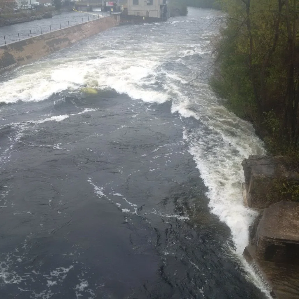
Also, area residents, as well as visitors to the area, are advised to observe caution around all waterbodies and watercourses because area lakes, rivers, streams and creeks pose a serious danger due to high levels, very fast flows and extremely cold water temperatures. Dams, culverts and other water control/water conveyance structures are to be avoided at all times.

This is a developing story. Follow @Ptbo_Canada on Twitter for the latest news.

Engage with us on social media on TwitterInstagramFacebook and Snapchat (ptbo_canada). Write to us at tips@ptbocanada.com. Sign up for PTBOBuzz newsletter here. Watch our PTBOCanada Love video here.