Most Areas In Peterborough To Have Restored Power By End of Tuesday

Most of the City is expected to have power restored by Hydro One while damage caused by Saturday’s severe windstorm is under repair.

File Photo.

The storm is causing extreme pressure on City of Peterborough public works, forestry, and waste collection services. Crews are doing their best to address storm damage and respond to the increased volume of material.

City crews are prioritizing requests for service related to downed trees along streets and sidewalks. With the extent of the damage, there is a significant backlog. Residents are asked to refrain from calling more than once to report a location. Requests are logged and prioritized.

As some streets may still be blocked by downed trees and power lines, some areas may not receive curbside waste collection on their scheduled day this week if crews are unable to safely access the area in waste collection vehicles at the time of collection.

Green waste

There is no limit on the quantity of green waste that can be placed at the curb; however, it must be put out within guidelines on sizes and weights to allow crews to handle the material. Due to the high amount of material, collection may be delayed.

Green Waste includes brush, branches, hedge and tree trimmings, grass clippings, leaves, house and garden plants, trimmings and small quantities of sod (within weight limits).

All brush and branches must be tied in bundles up to one metre (three feet) in length and 30 centimetres (12 inches) in diameter, weighing no more than 23 kilograms (50 pounds). Larger-size items cannot be loaded into the collection vehicle.

Stumps, soil and stones are not accepted through the green waste collection.

As an alternative to curbside collection, the City accepts green waste at the Bensfort landfill at a fee of $7 for 100 kilograms or less of material or for $95 per tonne for the entire load.

For green waste collection questions, please call 705-745-1386.

Garbage

For this week and next week, the City will be adjusting its garbage collection guidelines to allow one extra garbage bag or one extra garbage can (lift) to be put out for collection for each household, increasing the limit to three from two, to accommodate the disposal of spoiled food due to the extended power outages.

A lift is:

  • One plastic garbage bag no greater than 66 centimetres by 90 centimetres and a maximum of 23 kilograms (50 pounds) in weight;

  • One garbage can no greater than 125 litres (30 gallons) with side handles and a lid and 23 kilograms (50 pounds) in weight; or

  • One item less than one metre (three feet) in length and 23 kilograms (50 pounds) in weight.

Peterborough residents may also take garbage directly to the landfill at 1260 Bensfort Rd. during operating hours. Please refer to the City website at peterborough.ca for further details.

For garbage collection matters, please call 705-745-1386.

For general waste management related questions, please call 705-742-7777, ext. 1657.

While the garbage collection limit is adjusted for the storm response, the City asks that residents please separate out recyclable materials before throwing out food waste. There is no limit on the amount of recyclables that can be put out for collection each week. Recyclable materials can also be taken to the Recycling Depot on Pido Road at no charge, 24 hours a day, seven days a week.

City facilities

City Hall at 500 George St. N. and the Peterborough Waste Management Facility/landfill on Bensfort Road will re-open for in-person services on Wednesday. The landfill is only able to accommodate transactions for customers using cash or customers with landfill accounts until its internet and phone service are restored (updates will be provided when services are restored).

Other City facilities are closed for public use for regular services on Wednesday.

Social Services will offer in-person service at the Peterborough Public Library, 345 Aylmer St. N. on Wednesday for emergency basic needs assistance for clients. For all other inquiries, clients should contact their case workers by phone or email. Social Services will transfer to the Social Services office on Charlotte Street when power is restored to that facility.

Peterborough Transit is operating regular service. The customer kiosk at the downtown terminal is currently closed due to the power outage.

Access to showers and charging for electronics

For anyone who needs access to showers, the City will provide access to showers at Peterborough Sport and Wellness Centre, Healthy Planet Arena and Kinsmen Civic Centre from 8 a.m. to 8 p.m. on May 25 and May 26 Individuals must ask to use the showers to get access to the amenities at the facilities.

For those looking to charge electronic devices and electronic mobility aids, the following locations will be available for charging devices (regular services at the locations will not be available) on Wednesday, May 25, 2022:

  • Peterborough Public Library, 10 a.m. to 8 p.m.

  • Peterborough Sport and Wellness Centre, 8 a.m. to 8 p.m.

  • Healthy Planet Arena, 8 a.m. to 8 p.m.

  • Peterborough Museum and Archives, 9 a.m. to 4:30 p.m.

Safety

The City strongly encourages residents to stay away from trees in parks and on trails. Assessment of damage continues. Damaged trees may not yet be identified or addressed, which may be hazardous with limbs that may fall. The cleanup following the storm is ongoing and it will take some time for crews to move throughout all of the City’s parks and trails.

Emergency services urge residents to only use 9-1-1 for emergencies. They are experiencing a higher-than-normal volume of non-emergency calls to 9-1-1.

Peterborough Fire Services reminds residents that open-air burning with wood is not permitted in the City. Only outdoor fire appliances that burn propane or natural gas are permitted. Chimneys and other wood-burning devices are not approved.

Residents are asked to refrain from raking green waste, including leaves and branches, into the streets as they are a hazard to cyclists and vehicles using the road, and it may block catch basins, which could lead to local flooding.

Community food programs

  • Community agencies continue to provide food programs, including:

  • Salvation Army, 219 Simcoe St., takeaway breakfast, 9 a.m. to 10 a.m., Monday through Friday

  • One Roof Community Centre, 99 Brock St., take away lunch, 1 p.m. to 2 p.m.

  • Kawartha Food Share continues to support its member food banks that are operating throughout the community

  • Community Care meals program

Engage with us on social media on Twitter, Instagram, Facebook and Tiktok. Write to us at tips@ptbocanada.com. Sign up for PTBOBuzz newsletter here.

Crews Arrive From The US To Help Local Hydro And Forestry Workers After One Of The Most Deadly Wind Events In Canadas History

Crews crossed the border on Monday to assist crews already working to clean up from Saturday’s storm in Ontario, Hydro One announced on their social media pages.

According to Hydro One, in the first 24 hours after destructive thunderstorms passed through the province, Hydro One crews have restored power to more than 360,000 customers throughout its affected areas in Ontario, with over 226,000 customers that remain without power.

Damage includes at least 800 broken poles, and just as many downed power lines, along with countless trees and large branches causing power outages.

According to The Weather Network, Saturday’s storm was a Derecho. The term derecho is Spanish for "straight head" as most of the associated wind damage is the result of straight-line winds that blast out of the storm, as opposed to tornadoes that spin.

The Weather Network reported Saturday’s derecho was one of the most destructive and deadly wind events in Canada’s history.

Engage with us on social media on Twitter, Instagram, Facebook and Tiktok. Write to us at tips@ptbocanada.com. Sign up for PTBOBuzz newsletter here.


Freezing Rain Expected In Peterborough Wednesday

Environment Canada has issued a special weather statement for Peterborough and surrounding areas for freezing rain on Wednesday.

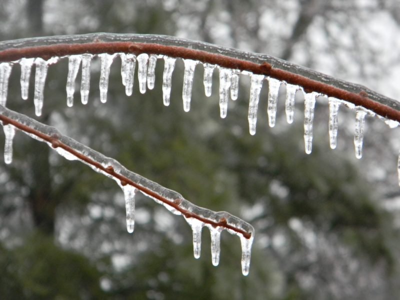
Stock Photo.

Freezing rain with ice accretion of 2 to 5 mm is possible, beginning Wednesday morning into the evening.

Freezing rain is expected to change to rain Wednesday afternoon or evening, 10 - 20 mm are possible. Flooding is possible.

In addition to rain and freezing rain, wind may reach 60 km/h, power outages are a possibility.

Road conditions are expected to be dangerous, it is suggested residents only drive if necessary and use caution.

Engage with us on social media on Twitter, Instagram, Facebook and Tiktok. Write to us at tips@ptbocanada.com. Sign up for PTBOBuzz newsletter here.


Otonabee Conservation Releases New Floodplain Mapping Studies To Better Predict Flood Paths In The Area

Otonabee Conservation has undertaken extensive floodplain mapping projects in seven high priority areas within the Otonabee Region watershed.

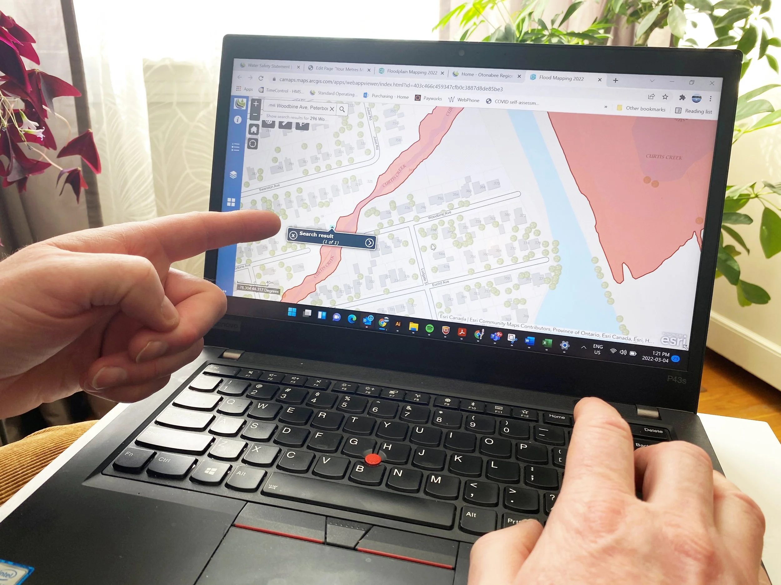
Photo courtesy of Otonabee Conservation.

Floodplain mapping has been created in study areas within Meade, Curtis, Jackson, and Baxter Creeks, North and South Kawartha Lakes, Ouse River in Norwood, and for several tributaries around Lakefield.

The objective of floodplain mapping is to identify the areas expected to be inundated during extreme high-water events.

Floodplain maps use data and technical models to predict the path of floodwaters—the area known as the floodplain. A floodplain map does not create a flooding hazard, it simply shows where the flooding will occur.

A map of the floodplain helps to determine where new buildings may be located and if a property is at risk during a flood or storm event.

“We will use the new floodplain maps to help protect property and human life,” explains Don Allin, acting manager of Plan Review and Permitting Services at Otonabee Conservation, “Our eight partner municipalities will also use floodplain maps to help direct future development outside the floodplain and by integrating them into municipal official plans we will all help to mitigate the risks of developing inside areas that are prone to flooding.”

Property and homeowners can also use floodplain maps to see if they may be affected by the floodplain. By searching their address, anyone can see if the property in question is at risk during a flood or storm event and in some cases, property owners may need to take measures to protect existing buildings from flooding.

Otonabee Conservation is hosting a Virtual Floodplain Mapping Public Information Centre (PIC) is from March 9 to April 9, to encourage questions and feedback from watershed residents about new floodplain mapping projects. To participate in the PIC

Visit otonabeeconservation.com for more information about the new 2022 floodplain mapping.

Engage with us on social media on Twitter, Instagram, Facebook and Tiktok. Write to us at tips@ptbocanada.com. Sign up for PTBOBuzz newsletter here.

Peterborough Police Urge Residents To Drive With Caution During Late Season Winter Storm

After reports of icy conditions in the area on Wednesday morning, Peterborough Police released a statement urging drivers to use caution when travelling.

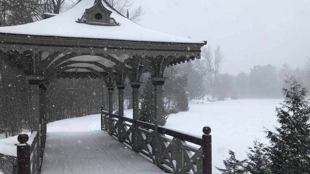
Photo by David Tuan Bui.

In an unusual late season storm threatens for more snow across southern Ontario Wednesday through Friday road conditions are unpredictable.

There is a possibility of freezing rain Wednesday morning.

Police suggest allowing for extra time before going anywhere and keeping a safe distance between vehicles.

Engage with us on social media on Twitter, Instagram, Facebook and Tiktok. Write to us at tips@ptbocanada.com. Sign up for PTBOBuzz newsletter here.


Flood Watch In Peterborough Area In Anticipation Of Up To 25 Millimeters Of Rain

Otonabee Conservation has issued a flood watch for all water bodies in the Peterborough area.

Affected areas include the Municipalities of Selwyn, Douro-Dummer, Asphodel-Norwood, Otonabee-South Monaghan, Cavan Monaghan, City of Kawartha Lakes, City of Peterborough and Trent Hills.

After experiencing a low-pressure trough that brought warm air temperatures, rain, and snowmelt to the Region last week, we will experience similar weather conditions on Tuesday as a Texas Low Pressure system passes over Southern Ontario. Air temperatures will soar to 6 degrees Celsius, and the system will deliver 20-25 millimetres of rain, possibly heavy at times.

Rain on snow on frozen ground will cause already above-normal water levels/flows to increase even more, possibly resulting in overbank flooding. However, if water levels do rise enough as to exceed channel capacity, it is expected to only do so in low-lying areas and to cause only nuisance level flooding. Ice cover break-up is not expected and flooding due to ice jams is also not expected. Wednesday, will see the system gone from the Region and a return to seasonal air temperatures.

Area residents can expect ponding of water in low-lying areas because frozen ground conditions will prevent absorption, followed by the freezing of this water as the air temperatures change back to below zero. Also, ponding will occur around culverts and drainage basins that are blocked due to snow, ice and/or debris. Residents and businesses along the shores of area waterbodies and watercourses, especially those located in low-lying areas, are strongly encouraged to keep a close watch for possible flooding and to take action to limit or prevent damages due to potential flooding. Adults, parents, and caregivers are advised to keep themselves, children, and pets away from all waterways and conveyance structures (i.e., dams, culverts, and bridges).

Water levels can be monitored on-line at:

1) Trent-Severn Waterway’s Water Management InfoNet

2) Water Survey of Canada Real-Time Hydrometric Data

3) Otonabee Region Conservation Authority website

This flood watch will expire Thursday unless otherwise noted.

Engage with us on social media on Twitter, Instagram, Facebook and Tiktok. Write to us at tips@ptbocanada.com. Sign up for PTBOBuzz newsletter here.


Freezing Rain Warning In Peterborough Area Monday Night

Environment Canada has issued a Special Weather Statement for the Peterborough area in anticipation of freezing rain occurring Monday night through Tuesday night.

The Special Weather statement is in effect in Peterborough County, Kawartha Lakes, Northumberland, Halliburton and Hastings County.

Freezing rain is expected to begin Monday night and continue into Tuesday, with rain during the day.

Flooding is possible. Road conditions are expected to become slippery.

Engage with us on social media on Twitter, Instagram, Facebook and Tiktok. Write to us at tips@ptbocanada.com. Sign up for PTBOBuzz newsletter here.


Snowfall Warning Issued For Peterborough And Kawartha Area

Environment Canada has issued a snowfall warning for most of the greater Kawarthas region for Thursday afternoon into Friday morning.

File Photo.

The snowfall warning is in effect for Peterborough County, Kawartha Lakes, Northumberland County, and Hastings County.

Precipitation will begin as rain Wednesday evening, with freezing rain and ice pellets possible Thursday morning and afternoon.

Snow will begin Thursday afternoon and continue through Friday morning. Total snowfall accumulations of 10 to 20 cm are possible. As the track of the low pressure system remains uncertain, precipitation timing and amounts may change.

Travel is expected to become difficult as road conditions are unpredictable.

Engage with us on social media on Twitter, Instagram, Facebook and Tiktok. Write to us at tips@ptbocanada.com. Sign up for PTBOBuzz newsletter here.


Flood Watch Issued For Peterborough Area In Anticipation Of Heavy Rainfall

A flood watch has been issued by Otonabee Conservation for all waterbodies and watercourses in the Peterborough region.

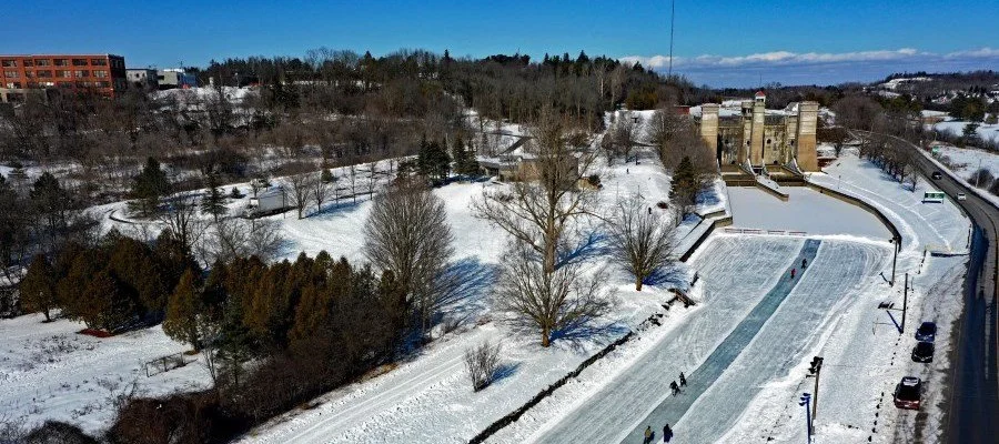
Photo courtesy of The City of Peterborough.

Areas that may be affected include Municipalities of Selwyn, Douro-Dummer, Asphodel-Norwood, Otonabee-South Monaghan, Cavan Monaghan, City of Kawartha Lakes, City of Peterborough and Trent Hills.

A low-pressure trough will bring soaring air temperatures reaching 6-7 degrees Celsius. Air temperatures will continue in this range over the next 36 to 48 hours ahead of an arriving cold front.

Also, ahead of the cold front is a total of 15 to 25 millimeters of rain. Depending on how the system tracks, there is a possibly that as much as 50 millimeters of rain will fall. As the cold front pushes into the region, there will be strong winds, a drop in air temperatures, and we will receive snowfall of 15 to 20 centimeters. This mix of vastly varying air temperatures, strong winds, differing forms of precipitation will make for messy conditions.

Uncertainty in total rainfall amounts translates to a possibility of flooding.

Current conditions include frozen ground covered by a snowpack that is 25-30 centimeters deep with a water content of 85-90 millimeters. Modelling of the warm air temperature/rain event shows 35-40 millimeters of rainfall/snowmelt will be available for run-off, possibly as much as 65 millimeters. However, the snowpack will absorb 5 to 10 per cent, helping to lessen the amount of rainfall/snowmelt to be released into area rivers, streams, creeks, and wetlands. Ice cover break-up is not expected.

Water levels can be monitored on-line at:

1) Trent-Severn Waterway’s Water Management InfoNet

2) Water Survey of Canada Real-Time Hydrometric Data

3) Otonabee Region Conservation Authority website

This flood watch will expire on Feb. 21.

Engage with us on social media on Twitter, Instagram, Facebook and Tiktok. Write to us at tips@ptbocanada.com. Sign up for PTBOBuzz newsletter here.

Extreme Cold Weather Warning In Effect For Peterborough Area

Wind chill values are expected to drop to -30°C for Peterborough and Kawartha Lakes Saturday and Sunday.

Environment Canada has issued an extreme cold warning for most the greater Kawarthas region for Saturday night into Sunday morning, and again for Sunday night into early Monday morning.

The extreme cold warning is in effect for Peterborough County, Kawartha Lakes, Haliburton County, and Hastings County.

Minimum low temperatures near -25°C with wind chill values near -30°C are expected Saturday night into Sunday morning for Peterborough County and Kawartha Lakes, with minimum low temperatures near -30°C and wind chill values near -35°C for Haliburton and Hastings counties.

Environment Canada suggest rescheduling outdoor events if possible.

Engage with us on social media on Twitter, Instagram, Facebook and Tiktok. Write to us at tips@ptbocanada.com. Sign up for PTBOBuzz newsletter here.