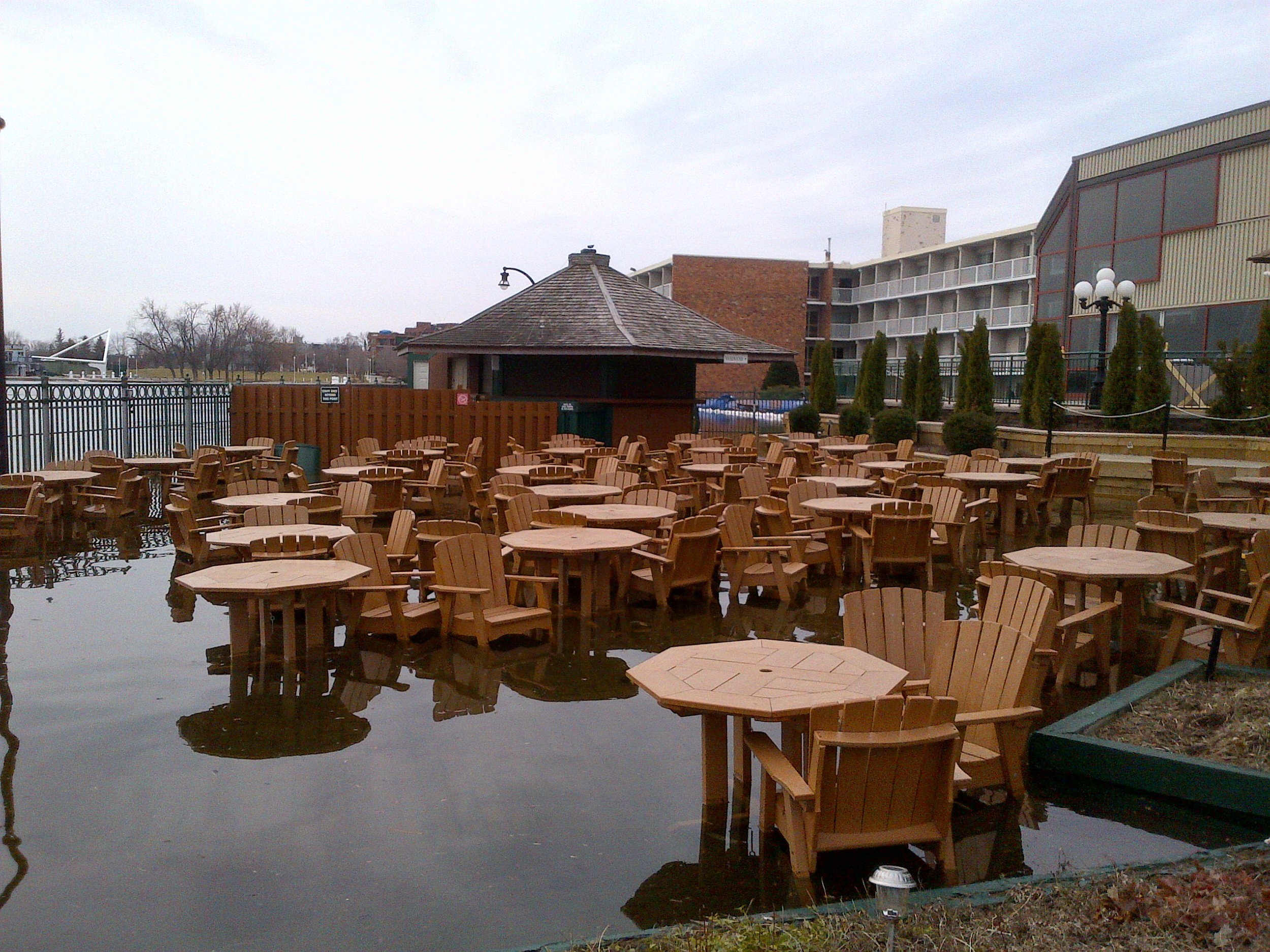
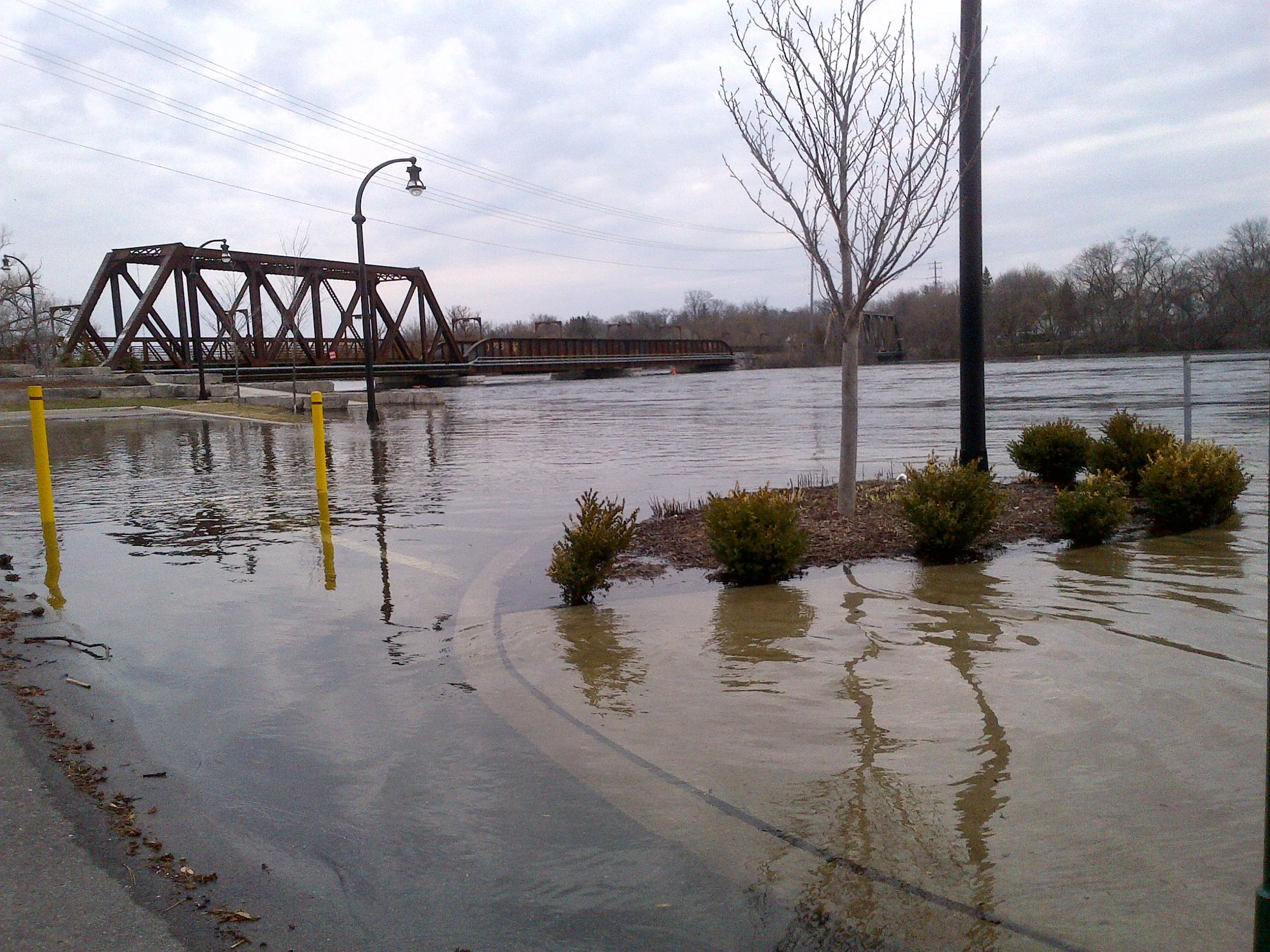
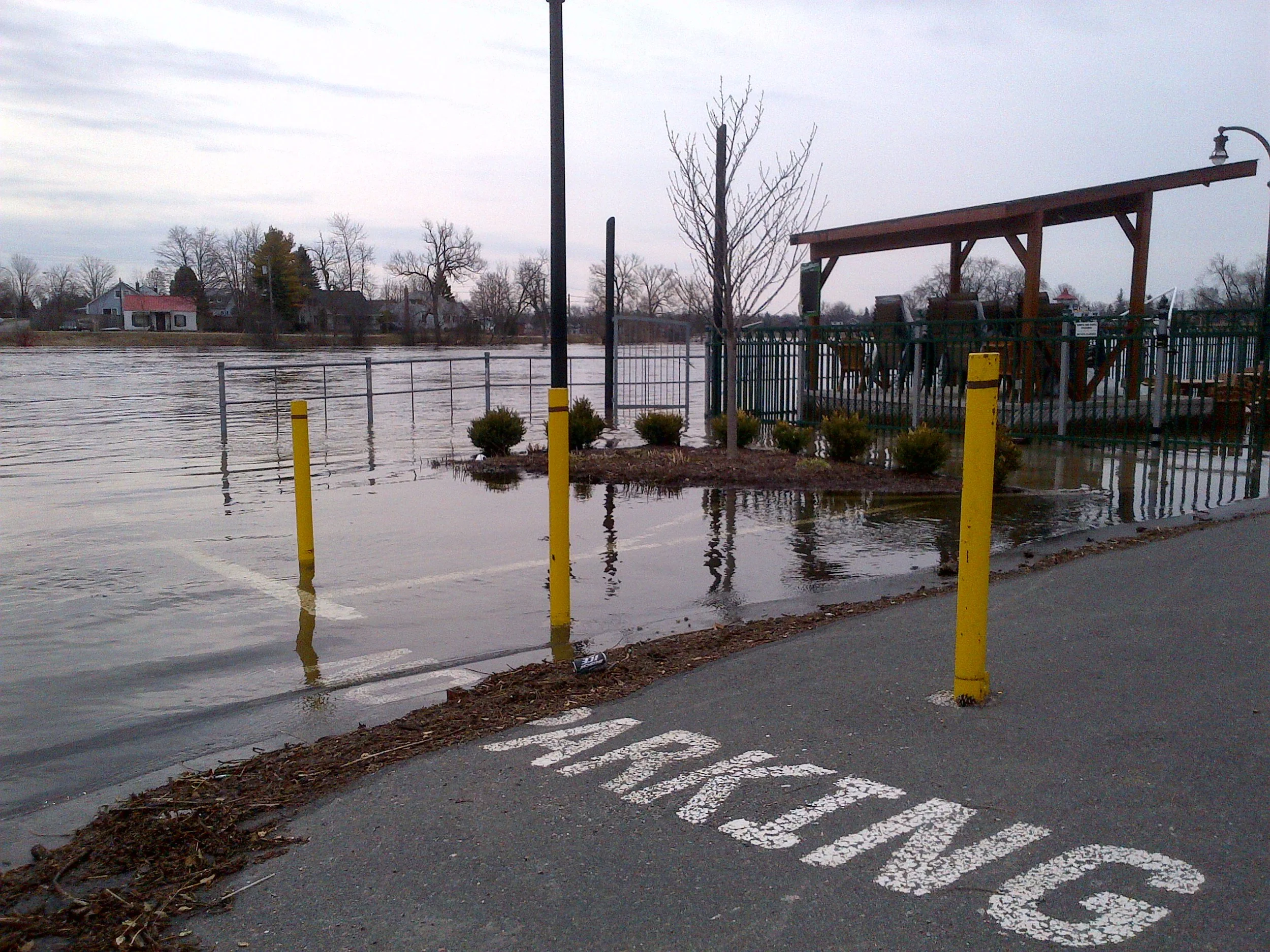
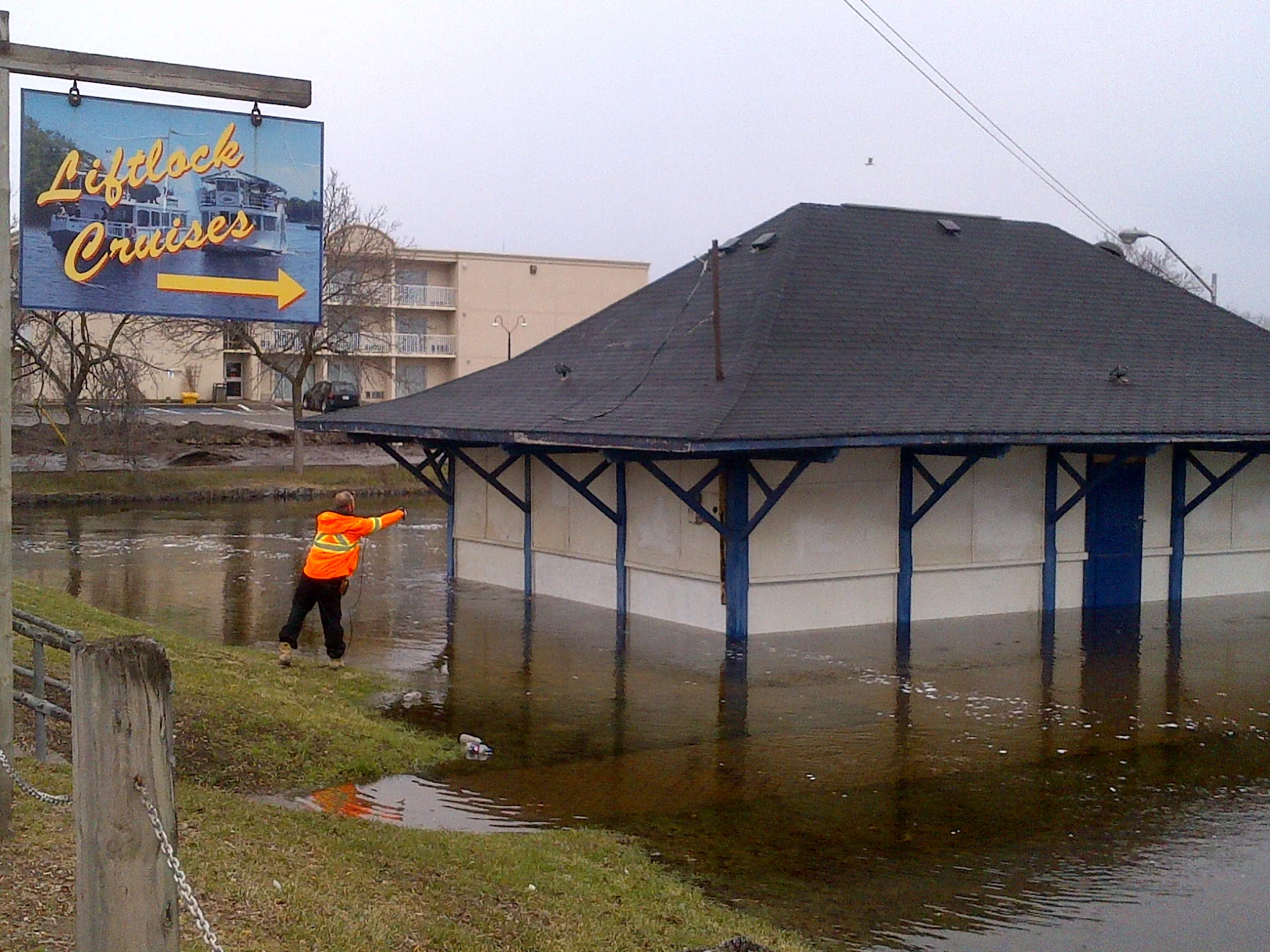
PTBOCanada Pics & Coverage From 2014 Peterborough Jane's Walk

Jane's Walk is a yearly celebration in memory of urban activist and writer Jane Jacobs, who promoted getting out and learning more about your community.

“No one can find what will work for our cities by looking at … suburban garden cities, manipulating scale models, or inventing dream cities. You’ve got to get out and walk.” 

—Jane Jacobs, Downtown is for People, 1957

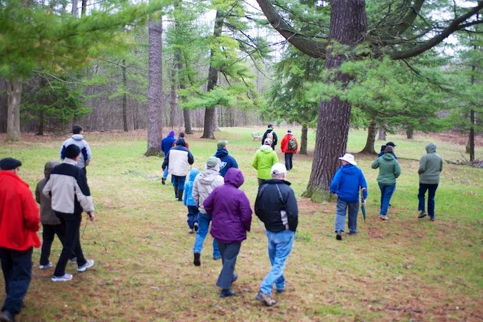
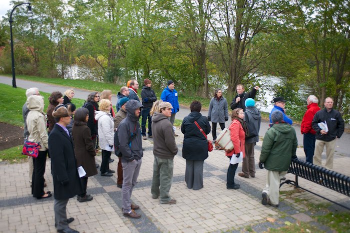
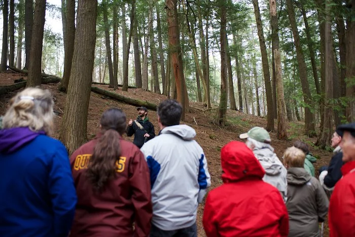
With the proposed bridge over Jackson Park, the Peterborough walk had a timely subject of Old Growth Forests in Jackson Park: Exploring Treasured Trees, Transitions, and Terminology. Walk leaders Chris Gooderham and John Etches guided us through Jackson Park, starting at the playground just off Monaghan and Parkhill.

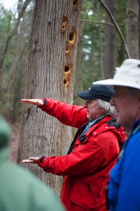
Rain and chilly temperatures didn't deter people from learning more about our local park, such as the non-living aspects of the woods that play a part on its growth. Rocks, dead leaves, air and water are some of the determining factors that impact how the woods form. Dying trees as non-living aspects of the land also have a trickle-down effect by bringing things such as woodpeckers to the area in search of food.

We looked at everything from the forest canopy above to topography of the land below and how things such as how the trees have grown in response to the slopes of the hills.

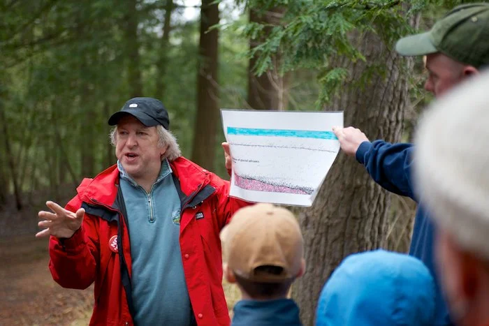
John gave us a historical look at how Peterborough is covered in Glacial sediment (rock and mineral) from the glaciers ages ago.

Chris has us look for a tree with signs of animal habitation. An Eastern White Cedar with an oddly red trunk was pointed out, which Chris described as a "home" tree, abraded by the activity of squirrels which has turned the bark red.

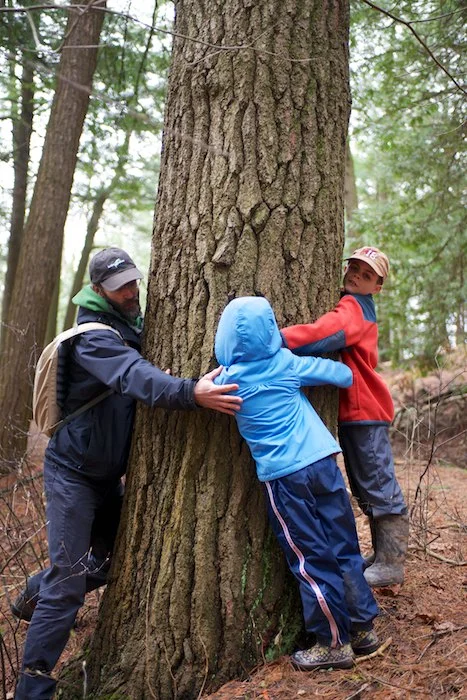
Jane's Walks foster conversation during the walk, and interactive elements. Chris, along with two volunteers, measured the circumference of an old tree—which is believed to be about 200 years old.

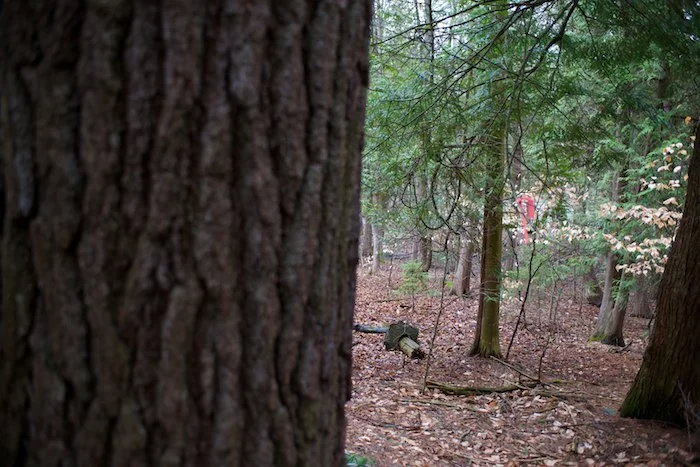
Adjacent to an old growth tree is a pink marker, indicating the edge of where the proposed bridge will cut through Jackson Park—taking the tree with it. Chris and John agreed that oddly enough, where the bridge is expected to be erected, is also the most biodiverse section of the Jackson Park forest. The whole walk really tied the big picture together of how this area came to be, and what its future might mean.

[Contributed by PtboCanada's Evan Holt]

Tip us at tips@ptbocanada.com. Follow us on Twitter and Instagram, and Like us on Facebook.

Look: Flooding In Peterborough

UPDATE: April 21st: ORCA advises things should begin to level off with the flooding along the Otonabee River over the next couple days—take a look at this video shot near Peterborough—but water levels remain high in the city (Del Crary Park is flooded), and rain is expected tomorrow. Take a look at these pics from today...

Silver Bean Cafe, pic via @LEGnCAS

Silver Bean Cafe, pic via @LEGnCAS

Lock St closed at King George St. & McKellar St. due to flooding, pic via @TVCPtbo

Lock St closed at King George St. & McKellar St. due to flooding, pic via @TVCPtbo

Backyards underwater at Graham St. & Lillian Ave, pic via @TVCPtbo

Backyards underwater at Graham St. & Lillian Ave, pic via @TVCPtbo

Quaker Park Tennis Club, pic via @TVCPtbo

Quaker Park Tennis Club, pic via @TVCPtbo

UPDATE April 20th: Yep, here's someone canoeing in Del Crary Park...

Canoeing in Del Crary Park, via @ScrappyLilAngel on Twitter

Canoeing in Del Crary Park, via @ScrappyLilAngel on Twitter

via @harleywpayne on Twitter

via @harleywpayne on Twitter

BREAKING: APRIL 20th. Here's the latest update from ORCA on flooding...

[UPDATE, April 20th]: These photos tweeted from above by Michael Alexander show the extent of flooding around Del Crary Park and Holiday Inn (protected by a giant water bag) on Little Lake...

Michael Alexander via Twitter

Michael Alexander via Twitter

Michael Alexander via Twitter

Michael Alexander via Twitter

Hugh MacMillan via Twitter

Hugh MacMillan via Twitter

Monaghan Road at the bypass, via Hugh MacMillan on Twitter

Monaghan Road at the bypass, via Hugh MacMillan on Twitter

Hugh MacMillan via Twitter

Hugh MacMillan via Twitter

Scott Arnold

Scott Arnold

Scott Arnold, Graham Avenue at Lillian St.

Scott Arnold, Graham Avenue at Lillian St.

[UPDATE, April 19th]: More pics from Scott Arnold of the flooding in Peterborough...

Crary Park entrance

Crary Park entrance

Water under Crary Park stage

Water under Crary Park stage

Crary Park under water

Crary Park under water

[UPDATE: April 19th]: BREAKING...
Flood Warning Update and Road Closure. A flood warning remains in effect for the City of Peterborough. The Otonabee Region Conservation Authority (ORCA) has advised that water levels will continue to rise in the lower Kawartha Lakes and Otonabee River over the next few days. City staff are closely monitoring the situation in consultation with ORCA, Trent Severn Waterway, Ontario Power Generation, as well as local dam operators, and are prepared to respond as required. Be advised that Lock Street at McKellar Street is closed to through traffic due to flooding. There is local access only. Please use alternate routes, such as King George and Park Street. Citizens travelling on Johnson Drive at the Highway #115 underpass are advised to use caution, as there is water over the roadway. Citizens are also advised to stay away from flooded areas and riverbanks due to fast moving water and the potential for unstable ground. City residents living in low-lying areas along the Otonabee River are encouraged to monitor water level changes on their properties, and to take necessary precautions to protect life and property. Docks and structures close to the water should be secured or moved, other personal effects should be moved to higher ground, and residents should consider moving personal belongings from lower levels of their home. Residents are advised that they should have sufficient and appropriate emergency supplies at the ready, and sump pumps and backflow preventers should be checked to ensure that they are functioning properly.

UPDATE No. 2 (April 18th): Here are photos by our Evan Holt of the Pedal 'n' Paddle (beneath the Silver Bean Cafe), which now has a few feet of water in it, and of East City...

UPDATED: Scott Arnold captured these dramatic images today (April 18th) of the flooding in Peterborough, as ORCA advises the situation is expected to worsen before it gets better...

Holiday Inn, protected by sandbags and huge water bag

Holiday Inn, protected by sandbags and huge water bag

Holiday Inn Waterfront Room

Holiday Inn Waterfront Room

Holiday Inn patio under water

Holiday Inn patio under water

Holiday Inn parking lot leading to walkway

Holiday Inn parking lot leading to walkway

Holiday Inn parking lot getting washed out

Holiday Inn parking lot getting washed out

Worker getting wires out of water and placing on roof

Worker getting wires out of water and placing on roof

Little Lake building under water

Little Lake building under water

Liftlock Cruise ticket booth

Liftlock Cruise ticket booth

Paddle boarders

Paddle boarders

Lock 20

Lock 20

Beavermead Park

Beavermead Park

ORIGINAL POST (April 17th)

The Otonabee Region Conservation Authority (ORCA) has advised that water levels will continue to rise along the Kawartha Lakes and Otonabee River over the next few days, as a flood warning continues for Peterborough. City staff are closely monitoring the situation in consultation with ORCA, Trent Severn Waterway, Ontario Power Generation, as well as local dam operators, and are prepared to respond as required. City residents in low-lying areas along the Otonabee River are encouraged to monitor water level changes on their properties, and to take necessary precautions to protect life and property.  The City of Peterborough Public Works will be providing limited sandbags to those City residents that are in imminent danger of flooding for lower entry points on foundations such as doorways and window wells (not for riverbanks). Sandbags will be available for City residents to pick up on April 18th from 7:00 a.m. to 7:00 p.m. in the Morrow Park parking lot; west lot, southwest corner. If at anytime city residents feel that they are in immediate danger by rising water, they should call 9-1-1. Scott Arnold captured these images (and video) below around Peterborough this evening (April 17th)...

Little Lake

Little Lake

Little Lake

Little Lake

Little Lake

Little Lake

McKellar St.

McKellar St.

Ducks on McKellar

Ducks on McKellar

McKellar St.

McKellar St.

Little Lake

Little Lake

McKellar

McKellar

—Scott Arnold

Tip us at tips@ptbocanada.com. Follow us on Twitter and Instagram, and Like us on Facebook.


Sacred Water Circle Gathering At Trent University May 2nd to 4th

The Sacred Water Circle Gathering, a powerful convergence of First Nations leaders and wisdom keepers, takes place at Trent University from May 2nd to May 4th. This indigenous-led initiative will bring together scientists, industry, academia, water professionals, the faith community and the general public with Elders and Traditional Teachers from all over the Americas. The Gathering will honour the sacredness of the water with ceremonies both at Trent University and Kinomagewopkong (the Peterborough Petroglyphs), traditional Indigenous teachings, interactive dialogue, art exhibits, film screenings, vendors and the performing arts. The registration fee for the three-day event is on a pay-what-you-can basis, ranging from $200 to $300, which includes all events, activities, meals and refreshments. Full registration information can be found at Sacredwater.ca. You can also register in person by visiting the GreenUP Store at 378 Aylmer Street in Peterborough. Registration closes April 18th. More info in this poster below...

Tip us at tips@ptbocanada.com. Follow us on Twitter and Instagram, and Like us on Facebook.

2014 Green Waste Pickup Has Started In Peterborough

Place your green waste in reusable containers with labels, bushel baskets or paper yard waste bags. No plastic bags. You can pick up labels at City Hall, Peterborough GreenUP and local Home Hardware stores.

Securely tie brush in bundles up to 1 m or 3 feet in length and 30 cm or 12 inches in diameter, weighing no more than 22 kg or 50 lbs.

For more information, visit the City of Peterborough's Waste Management Services website.

[Contributed by PtboCanada's Evan Holt]

Tip us at tips@ptbocanada.com. Follow us on Twitter and Instagram, and Like us on Facebook.

A Look At Upcoming Parkway Meetings This Month

November looks to be a busy month for Parkway news...

ParkwayCorridorMeetingNov2013.gif

On November 13th at 6:30 p.m., a special Committee of Whole meeting will be held at the Evinrude Centre (911 Monaghan Road) for a presentation of the Parkway Corridor Class Environmental Assessment.

The meeting is open to the public, however due to a Peterborough Procedure By-law the public is not allowed to speak.

But you will have your chance on November 20, 2013 at 6:30 p.m. when a special public City Council meeting will be held at the Evinrude Centre.

ParksnotParkways.jpg

Parks Not Parkways: A Concert for Greenspace is on November 17th at Market Hall and features The Three Martinis, Rick Fines, Kirsten Addis and Al Black and the Tonemasters. It is a benefit concert for the Peterborough Greenspace Coalition, who are devoted to the protection of green spaces in our city. Tickets are $20.


There are two Change.org surveys that you can take part in to vote FOR or AGAINST the parkway.

More here in this video of Jackson Park. 


[Contributed by PtboCanada's Evan Holt]

Tip us at tips@ptbocanada.com. Follow us on Twitter and Instagram, and Like us on Facebook.

PTBOCanada Pics & Coverage: Peterborough Cycling Summit 2013

PtboCyclingSummitSignin.jpg

The Third Annual Peterborough Cycling Summit was held on Friday (October 25th) at the Holiday Inn and featured afternoon workshops to do with cycling both here in Peterborough and the Kawarthas, and stretching throughout the province. Although we couldn't attend all of the workshops, here is a look into a few of them...

Cycle Touring: The Kawarthas and Beyond

This workshop had three speakers...

PtboCyclingSummitKieran.jpg

Kieran Andrews:  “Cycle touring is way more than riding bikes. It’s about quiet roads, unique experiences and beautiful places. That’s what we’re all after.” While Kieran is quite content with just heading down an unknown road to see where it leads, it may not be your ideal decision when trying to plan a route with a limited time span. His main suggestion during his talk was to use MapMyRide.com as both a planning tool and a progress meter. Through the website, you can pick prospective cycling destinations (or find ones in your own area that others have recorded) to see both via map and elevation how challenging it may be, the road type (gravel, paved, etc.) and how much traffic it may see. 

PtboCyclingSummitLouisa.jpg

Louisa Mursell: Projects Director with Transportations Options, which is a non-profit organization that has been around for 20 years that helps to further develop sustainable transportation. Lately they have been working on tourism initiatives including cycling. Amongst their programs are Bike Train (to increase bike options for cyclists in Ontario), and Park Bus (bus transit to Ontario Parks locations).

Through the Welcome Cyclists network, they have discovered that cyclists were not fully satisfied with lodgings in areas. You can visit the Welcome Cyclists website to help plan trips, and find accommodations that are bicycle friendly and provide secure bicycle lock-up area. The accommodation must have local cycling maps or websites to help with this information, as well as access to repair tools or be in close vicinity to a bicycle shop. Healthy food and free access to water is also key as well. Prospective businesses that would like to join just have to sign up online (for free) and attend a Welcome Cyclists seminar. There are currently 65 businesses in the Kawartha-Northumberland-Peterborough area (most are in Northumberland County). 

PtboCyclingSummitSusan.jpg

Susan Sauvé: Talked about touring through France by bicycle. She found the hospitality very good along with growing places that have public laundry and Wi-fi (although because of the differences in power outlets, sometimes it was tricky to charge your devices). Sue was pleasantly surprised to find so many bicycle trails and bicycle sharing programs throughout Paris. The three then fielded questions from the audience about cycling touring.

PtboCyclingSummitSelwyn.jpg

Selwyn Township: Our Trail moving forward, connecting you to better health

John McMullen let us know that that because of healthy lifestyles, and the effort to reduce greenhouse gasses, trails have become a major part of the Selywn township masterplan. The four main trails are the Lakefield Trail, the Bridgenorth Trail, the Ennismore Heritage Trail and the Trans-Canada Trail, but there are also many additional popular hiking trails. They have already had public consultations—through surveys and open houses—from which they learned that Bicycle lanes were one of the higher ranked things, followed by linking the areas together.

PtboCyclingSummitSelwynMap.jpg
PtboCyclingSummitSelwynMap2.jpg

Displayed around the room were maps of each of the hamlets of Selwyn township. John asked everyone to put a sticker on the area in each hamlet where they would like to prioritize improvement. 


PtboCyclingSummitPBAC.jpg

Peterborough: Setting the Course

Tegan Moss from the P-BAC (Peterborough Bicycle Advisory Committee) and Peter from Green-Up are trying to create a cycling culture here in Peterborough by providing input into both infrastructure and advocacy projects.

PtboCyclingSummitCompleteSt1.jpg
PtboCyclingSummitCompleteSt2.jpg

This workshop's focus was on "Complete Streets" which is the design infrastructure and maintenance necessary for all road users to enjoy using the road safely. Each table tackled projects that are slated for construction in Peterborough during the next five years that currently do not have a design. Using cardboard placeholders, the idea was to design the layout of streets such as Chemong, Ashburnham, George and Water to incorporate access for both vehicles, bicycles and parking alike. Each game board had markers to indicate scale so each street layout had to comply with real-world dimensions. Afterwards, photos were taken and the layouts will be submitted as possible designs.

Tour of Downtown

PtboCyclingSummitWalk.jpg

Attendees were welcomed to join a tour lead by Susan Sauvé and Urban Design Planner Brian Buchardt. They were treated to a short walk downtown to showcase elements of the current and future design downtown, such as our new footpath beside the train bridge.


PtboCyclingSummitDonald.jpg

The evening's events were opened by Donald Fraser who thanked such a passionate and growing number of attendees for coming. A message from Jeff Leal (who was unable to attend) was read that mentioned that the Ontario government is aiming for a 2031 date to both recognize cycling as a core mode of transportation and a goal to make Ontario the Number one province for cycling in Canada. The Ontario Cycling Strategy which was just recently released promotes a healthy and active lifestyle, tourism strategy and health benefits. This strategy will roll out through action plans throughout the coming years, with the first kicking off next Spring.

PtboCyclingSummitElenor.jpg

Eleanor McMahon from Share the Road read a letter on behalf of Glen Murray, the Ontario Minister of Transportation and Infrastructure who gave a nod to P-BAC, The Peterborough-County City Health Unit and the Ontario Professional Planners Institute-Lakelands District for their hard work. He also echoed the hopes to make Ontario a lead cycling destination.

PtboCyclingSummitLesley.jpg

City Councillor Lesley Parnell spoke on behalf of the Mayor and Peterborough City Council. They are pleased to support cycling culture in Peterborough and proud to promote all the health benefits that cycling brings. Mayor Bennett is a believer in the “A bike friendly city is a livable city, and a liveable city is a bike friendly city.”

PtboCyclingSummitSue.jpg

Sue Suavé: The City passed a new updated Compressive Transportation Plan in 2012 which has 183 KM of bikeways in the City alone. They have $500,000 a year to spend on capital to make projects happen such as on multi-use trails and on-road bike facilities. Right now we have 55 km of the network built (30%). Sue showed how over the years our cycling network has expanded. In addition to the trails, we also now have 156 new bike parking spaces within areas such as downtown and East City which brings the total to 629 downtown.

For a sneak peek into future projects, Sue let us know about such things as…

  • Ashburnham drive, which is being reconstructed in 2015 and the City is looking to add what is known as a cycling track (a slightly elevated bike lane)
  • The Parkway trail, which currently ends at the railroad tracks, will continue to Crawford drive next year
  • They will complete the Trans-Canada Trail; this will continue on the South side of Maria street as a three meter paved trail
  • George Street improvement project will include bike lanes in both directions
  • Otonabee River Trail is currently under an environmental assessment, and hopes to be extended from Del-Crary Park right around to the Little Lake Cemetery (and one day will extend all around Little Lake)
  • The bike lanes on Water and George street will be upgraded in 2014
PtboCyclingSummitMary.jpg

Mayor Mary Smith from Selwyn Township and Chris Bradley from Director of Public Works for Peterborough County. Mary pointed out how many County Councillors were in attendance as they are committed to building trails and do the appropriate planning.

PtboCyclingSummitChris.jpg

Chris Bradley: The Transportation Masterplan was recently completed which contained updated walking and cycling processes (which are different between the County and the City). Some of the improvements to come are shared road-lanes (which are already being constructed in Smith Township), paved shoulders, designated striped bike lanes, separated buffered bike off-road multi use trails, and a lot of active transportation planning still to come. Chris shared a sidenote: that when the Public Works Department Building on Armour Road was redesigned for use, showers were added for when people cycled or ran to work. Chris mentioned that they are trying to link the communities and are always trying to consider the needs and the potential for bike lanes (and walkability of the roads). Cycling lanes are suggested for the Gifford Causeway (which runs between Bridgenorth and Ennismore) and reconstruction on Ward Street which is slated to be widened. Input from last year's cycling summit has already gone into the new masterplan. One important area that Chris highlighted was Airport Road. They are just completing the final design now for reconnecting it and the project is moving forward.

PtboCyclingSummitKeynoteDrLee.jpg

 The keynote speaker was Dr. Karen Lee whose topic was "The Role of Design and Infrastructure in Addressing Cycling and Health". She talked about how history repeats itself with the infectious diseases of the 19th century and the chronic diseases of the 21st century. Through infrastructure changes, there was a decrease in infectious diseases, however something needs to be done for our current issues. Dr. Lee displayed a disheartening animation of Diabetes trends among U.S. adults from 1994 to 2009 which also equates to higher medical costs. This trend also applies to Canadians as we aren't getting enough exercise. It was suggested that we could again correct this through infrastructure changes to encourage active transportation and greater access to physical activity. Side benefits included a reduction of infrastructure costs and job creation. Our favourite slide had some Peterborough statistics that compared 1947 to now. While our  65+ population has slightly risen, Peterborough has less people per acre, has more employment in the Service Sector, and the percentage of City's Non-Food Retail Space in Downtown has actually dropped considerably. Be sure to view Dr. Karen Lee's presentation and also take note of New York's Fit-City initiative that has promoted healthy living through design.

You can view each presentation on the P-BAC website

[Contributed by PtboCanada's Evan Holt]

Tip us at tips@ptbocanada.com. Follow us oTwitter and Instagram, and Like us on Facebook.

Must Watch: The Tale Of Jackson Park & The Parkway Trail

Parks Not Parkways Campaign is trying to stop the building of a massive bridge and arterial road through two of the most beautiful greenspaces in Peterborough. Learn more about the campaign in this amazing aerial video footage of the park...

[via Parks Not Parkways

Tip us at tips@ptbocanada.com. Follow us on Twitter and Instagram, and Like us on Facebook.  

Peterborough Participates In Park(ing) Day This Friday

ParkingDay.jpg

Friday, September 20th, marks the annual worldwide PARK(ING) DAY. This is the day where cities and communities voluntarily transform parking spaces into park space for one day. This initiative is to help bring awareness for the need for more urban green space. On this day, Peterborough will be transforming a parking space on Sherbrooke Street near The Avant-Garden Shop into green space. With a little sod and some lawn furniture, a beautiful park space will be created. Check out the Facebook event for more details on Peterborough's involvement to help celebrate this great day. 

[Contributed by PtboCanada's Julie Morris]

Tip us at tips@ptbocanada.com. Follow us on Twitter and Instagram, and Like us on Facebook.

Chalk Talk: Mayor Daryl Bennett

ChalkTalkDarylBennett.jpg

PtboCanada's Chalk Talk is a snapshot of people's favourite thing about Peterborough. Watch for us around town as we would like to feature your favourite thing too! In this edition of Chalk Talk, Mayor Daryl Bennett was very enthusiastic about "The volunteer spirit of Peterborough!"

[Contributed by PtboCanada's Evan Holt]

Tip us at tips@ptbocanada.com. Follow us on Twitter and Instagram, and Like us on Facebook.

City To Begin Heritage Conservation District Study In The Avenues

Screen shot 2013-07-14 at 2.19.54 PM.png

 From a City of Peterborough release...

Based on the outcome of conversations with the community, the City has decided to undertake its first Heritage Conservation District Study in the area known as the Avenues.

Catherine Nasmith, a nationally recognized expert in heritage conservation districts was hired by the City to lead two public workshops on the value of conservation districts. The second session focused on discussions with residents in three areas, the Avenues, the Old West End and Dickson Mills, where residents had expressed a high level of interest in pursuing heritage designation.

All three neighbourhoods emerged as suitable areas for Council’s consideration and the Avenues will be the first area to be studied. Comments by residents of the Avenues almost unanimously supported heritage designation as a way to protect the parts of their neighbourhood they cherish. When asked what they would be sad to lose in the Avenues, responses included such things as the porches and verandahs, back lanes, mature trees and the area’s walkability.

“Peterborough is a city that has been nationally recognized for its leadership in heritage conservation, and a first Heritage Conservation District study is an important step in protecting and celebrating that heritage,” said Mayor Daryl Bennett.
The request for proposals from consulting firms experienced in completing conservation district studies has been issued and staff will be reviewing the submissions in early August. The study is scheduled to begin in September with the consultant’s recommendations going to Council in the spring of 2014.

Tip us at tips@ptbocanada.com. Follow us on Twitter and Instagram, and Like us on Facebook.